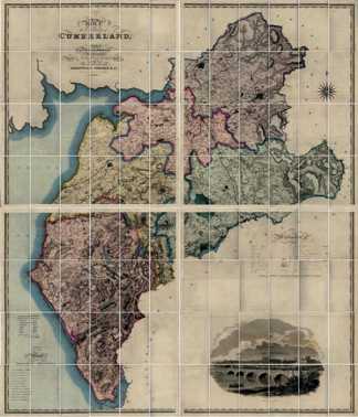
Greenwood's County Maps of Cumberland and Westmorland, surveyed 1821-3
These are folding maps at a scale of 1 inch to 1 mile, first published in 1823-4. The second edition available here was published in 1844 using the original survey but with routes and names of railways added to the engraving to that date, and with later railways to 1847 added by the colourist. An article from Journal 54 on these maps by Derek Denman can be read here.
In the second edition Cumberland was covered by four folding maps, North West, North East, South West and South East each of which contained 24 paper sections glued to a linen backing. Westmorland was covered by two maps, North and South, each of which contained 20 paper sections.
This website allows the 136 sections of the two maps to be individually viewed or downloaded in .jpg format at the original size.
The copyright of these maps expired long ago. The Society holds original copies of these maps and grants a public free licence for the general use by others. This could include using sections or combinations of sections from the maps on these web pages as illustrations in publications, provided that acknowledgement is made of the source.
Click the Cumberland or Westmorland image
The late Michael Grieve, 1932-2014
The online publication of these maps is made possible by the bequest to the Society of the originals by Michael Grieve. Michael was the founding Secretary of the Society in 1993, being Secretary and Newsletter editor for over ten years before moving to Somerset. He had a keen and practical interest in historical maps, which is remembered by this project.
On Other sites: Copies of the Cumberland, Westmorland and North Lancashire maps first edition are at http://www.geog.port.ac.uk/ .../grw5fram.htm


